

Fight for Every Inch Against 30×30
The 30×30 campaign is a major effort to lock up 30% of the nation’s land by the year 2030. Anyone who has read the details of how this plan will be implemented understands it is a clear effort to lock the American people out of their land. While there is no legislation to designate these exact parameters, the way 30×30 proponents will achieve this goal is through restrictive land use designations. There will be no bill that is presented to the federal legislature to lock up 30% of the land. These extreme groups will slowly do this, working around the clock, to designate monuments, wilderness, wilderness study areas and areas with wilderness characteristics. These designations come sometimes through executive orders, but in many cases they will come through land agency management plans. We created the Fight for Every Inch campaign to create a movement to push back!
National Monuments
Recently the Biden Administration used the Antiquities Act to designate national monuments in Southern Utah. Grand Staircase-Escalante and Bears Ears are a crucial piece to the 30×30 puzzle.
The State of Utah recently filed a lawsuit to challenge these monument designations.
BlueRibbon Coalition also filed a companion lawsuit to also challenge the monuments. Both the State of Utah and the BlueRibbon Coalition challenges are based on a commitment to see the Supreme Court weigh in on abuse of the Antiquities Act by President Biden. For a full briefing our Executive Director, Ben Burr, explained our justification for this challenge in an opinion editorial for the National Review.
As one of the only organizations laying the groundwork to defend your outdoor recreation access all the way to the levels of the Supreme Court, we hope you will consider making a charitable donation to give us the resources we need to succeed in these fights.
Wilderness
Wilderness is the most restrictive form of land management and has to be designated through Congress. There are currently several bills in Western states that would designate millions of acres of wilderness.
BRC is actively tracking all of these bills, and we encourage you to take action to oppose the bills that will expand wilderness.
Wilderness Study Areas/Areas with Wilderness Characteristics
You will find as the BLM and Forest Service update management plans, they propose areas that could potentially become wilderness. We call this wilderness laundering. There are currently management plan and travel management plan proposals in Utah, Colorado, Nevada, South Dakota, Wyoming, Arizona, New Mexico, Idaho, Oregon and Montana with more to come.
BRC is involved with these plans every step of the way. We need you to comment, to discourage the shutdown of public access in these areas.
With the current administration, land agencies are being very aggressive and rolling out proposals at a fast rate. As all of these new proposals continue, we need your help to submit comments. 30×30 won’t happen overnight with one large bill but piece by piece through these small processes. BRC is committed to fighting this every step of the way to Fight for Every Inch and we need your help. The best way to ensure that you have all the tools you need to join us in this fight is to become a premium member of BlueRibbon Coalition.
Review our Recent Work Where We Empower your to Fight for Every Inch
54% of Roads Proposed for Closure in Southeast Arizona Gila San Simon Travel Management Plan
Gila-San Simon Travel Management Plan- The Safford Field Office, located in the south eastern corner of Arizona is beginning Travel Management Planning. 2,391.5 miles on 951,842 acres. Surrounding Safford, Arizona the project boundaries include areas such as: Gila...
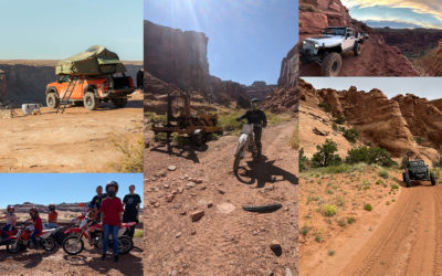
RELEASE: Coalition of Off-Roaders Challenges Imminent Closure of 317 Miles of Trails Near Moab, UT
Today, the BlueRibbon Coalition, joined by the Colorado Offroad Trail Defenders and Mr. Patrick McKay, challenged a decision by the Bureau of Land Management (BLM) to close 317 miles of some of the nation’s best off-roading trails near Moab, Utah. If allowed to stand,...
Chumash Marine Sanctuary-Restricting more than meets the eye
The National Oceanic and Atmospheric Administration has proposed moving forward with designating the Chumash Marine Sanctuary in California. This sanctuary is being sold as a way to protect valuable ocean waters and species through this designation. From an...

Millions of Acres Proposed as New Conservation Area in Montana
Fish and Wildlife Service is proposing a 5.8 million acre conservation area in southern Montana along the Idaho border. Comments are accepted until November 27, 2023. The Missouri Headwaters Conservation area, if approved will attempt to acquire private lands within...
The BRC Action Plan for Moab – Five Actions You Can Take to Fight for Our Trails
The picture above is the Taylor Canyon Overlook located at the end of a route that the Bureau of Land Management lovingly refers to as Route 1026B. It is one of the 317 miles of trails that will be closed by the final travel plan that the BLM released for this area...
STOP 30X30: BRC attends summit in Texas to oppose locking up 30% of the US land and water by 2030.
September 21-23, 2023 BlueRibbon Coalition Executive Director, Ben Burr, Policy Director, Simone Griffin and board member Mark Maynard attended the Stop 30X30 summit held in Dallas Texas by the American Stewards of Liberty. Attendees gathered to learn and collaborate...