This is the fourth travel management planning environmental assessment that has been released in the Owyhee’s area of Idaho within the past 6 months. Because of engagement of the motorized community, the alternatives presented reflect the need for motorized access. Comments until February 12, 2024. Fill in the information below to send a comment, and include your own personal experiences. You can read the full analysis of the plan below.
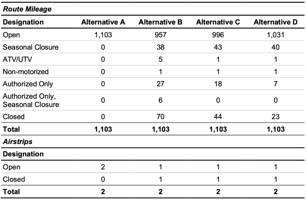
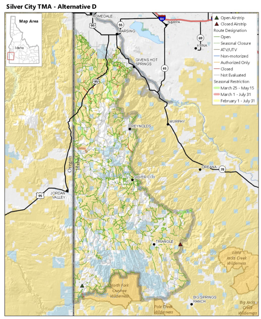
This travel area affects 818,000 acres and is the area of the towns of Homedale and Marsing. Alternative D will only permanently close 2% of routes which is one of the best plans we have seen proposed as they typically are proposing to close 50% of routes in travel areas. Seasonal closures are for sage grouse lekking and bald eagle nesting sites. However, many times recorded nests of wildlife are surrounding heavily traveled routes as we have recently seen in the Wyoming Rock Springs resource management plan. Therefore, this should not be a reason to close these routes permanently.
The BLM has stated in the environmental assessment, “motorized use tends to be moderate and related to access for livestock grazing, hunting, trapping, river floating, and motorized recreation.” Those uses have a right to continue using these routes. There are also many routes the BLM is considering a “user created route” and is not considering to officially add it into the trail system and recognizing it as a motorized route. These routes should be formally recognized and open for the public to use.
Through this plan, we would also like to see the BLM protect routes to dispersed camping sites, allow e-bikes and even consider new routes for e-bikes as there are not many non-motorized routes.