
The proposed changes to the Uncompahgre Resource management Plan in western Colorado is a prime example of how 30X30 is being achieved in the United States. Due to a settlement agreement the Uncompahgre Field Office is re-evaluating how lands in the Uncompahgre management area will be managed for wilderness characteristics and areas of critical environmental concern also known as ACEC’s. This plan will update the 2020 Resource Management Plan for the area. It is located in Delta, Gunnison, Mesa, Montrose, Ouray, and San Miguel counties, Colorado, and encompasses approximately 678,400 acres of public land. Submit a comment below to voice your opposition to adding hundreds of thousands of acres of public land to restrictive management designations:
Full Briefing
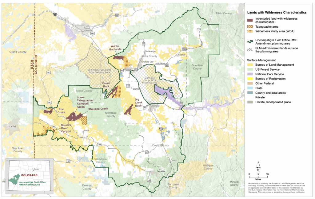
As per the Wilderness Act, Congress has the authority to designate lands as Wilderness. However, through resource management plans agencies such as the Bureau of Land Management will still manage lands as though they are Wilderness if they identify these lands as having “wilderness characteristics”. Ultimately they are bypassing Congress because the federal legislature never passed any law to designate these lands as wilderness. Oftentimes lands being managed with wilderness characteristics have previously had roads and motorized access and are now being prohibited. These designations will affect motorized access and recreation, grazing, mining, rock hounding, camping and any other way the public enjoys this public land.
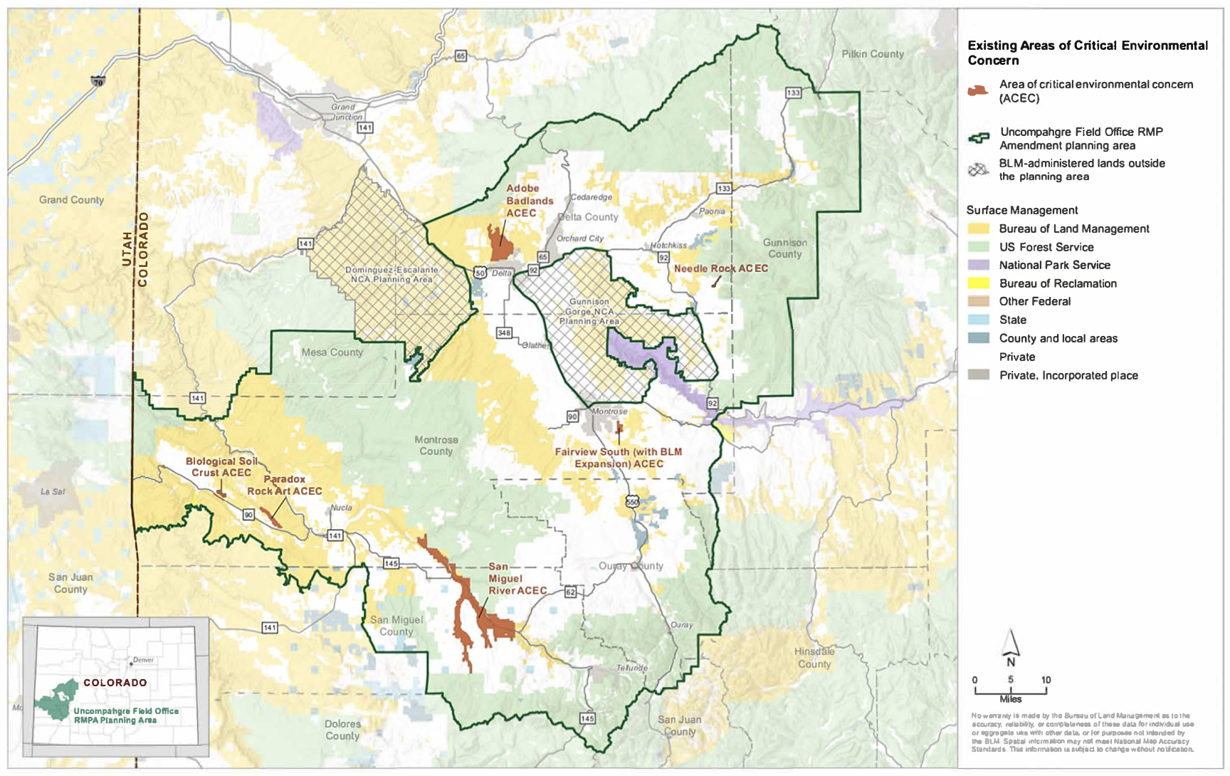
There are currently the following areas being protected as an ACEC:
ACEC’s: Adobe Badlands ACEC/Outstanding Natural Area (ONA)/Instant Study Area (ISA) (6,370 acres), Biological Soil Crust ACEC (390 acres), Fairview South BLM Expansion ACEC (610 acres), Needle Rock ACEC/ONA (80 acres), Paradox Rock Art ACEC (1,080 acres), and San Miguel River ACEC (21,660) acres
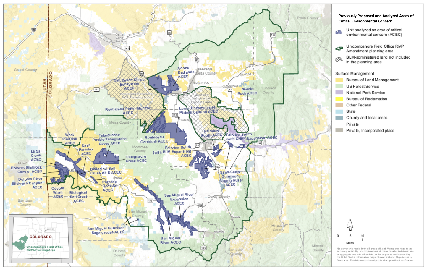
However the BLM is now considering even more ACEC’s for a total of 246,400 acres. If you’ve wandered what a land grab looks like, this is it. Previously designated ACEC’s are fairly reasonable. They’re small in size to protect a specific resource, totaling just over 30,000 acres. By adding in these additional ACEC’s we have an increase of acres being managed as such by over 200,000 acres.
following ACEC’s will be considered:
- Coyote Wash ACEC – 2,100 acres
- Dolores Slickrock ACEC – 10,670 acres
- East Paradox ACEC – 7,630 acres
- Fairview South CNHP Expansion ACEC – 4,250 acres
- La Sal Creek ACEC – 10,490 acres
- Lower Uncompahgre Plateau ACEC – 31,810 acres
- Needle Rock ACEC – 80 acres
- Paradox Rock Art ACEC – 1,080 acres
- Roubideau-Potter-Monitor ACEC – 20,430 acres
- Salt Desert Shrub Ecosystem ACEC – 34,510 acres (includes the existing Adobe Badlands ACEC)
- San Miguel Gunnison Sage-Grouse ACEC – 470 acres)
- San Miguel River Expansion ACEC – 35,480 acres
- Sims-Cerro Gunnison Sage-Grouse ACEC – 25,620 acres
- Tabeguache Pueblo and Tabeguache Caves ACEC – 26,400 acres
• West Paradox ACEC – 5,190 acres
The problem with ACEC’s is they are not defined well whatsoever. The BLM defines an ACEC as an area that needs special management protection. The BLM was never given authority to designate ACEC’s by Congress. There are already several special management protections given to public lands such as Wilderness, special recreation management areas, conservation areas, etc. The BLM will also claim that motorized access CAN be allowed within an ACEC however not always. There are more examples of not of roads being closed because they are within an ACEC. These designations are dangerous, because once they are there we don’t see them go away and the amount of closures that happen after they are in place go up.


The 30X30 plan is a giant land grab for people that want to throw motorized travel off public lands. This plan is NOT what the public wants! Don’t think for a minute the BLM cares!