
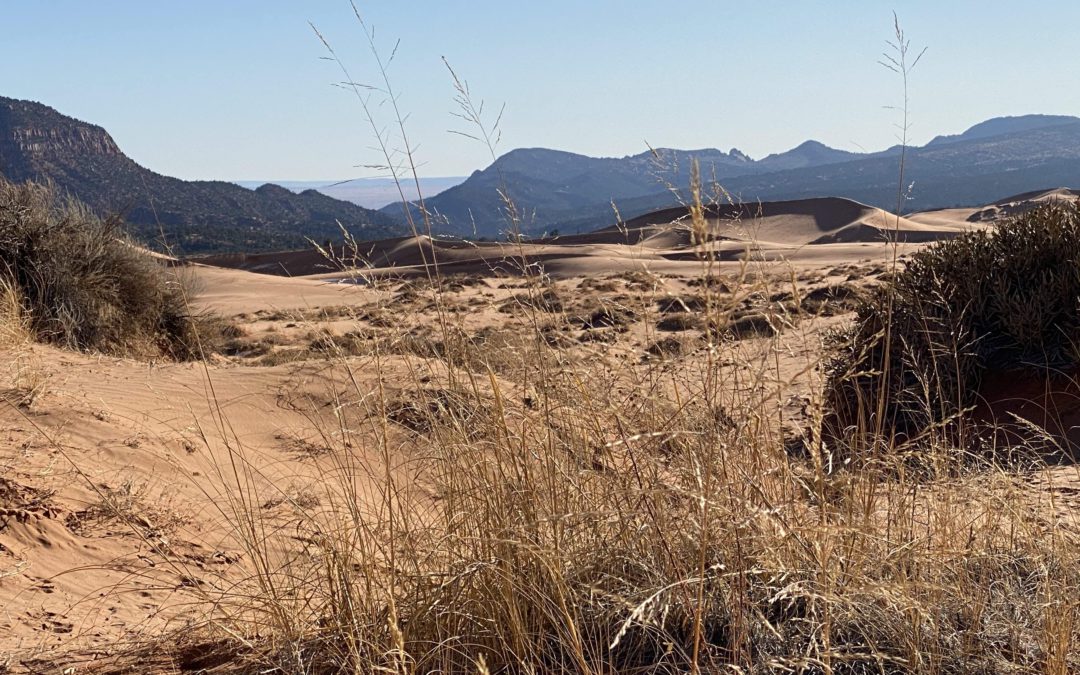
Overview:
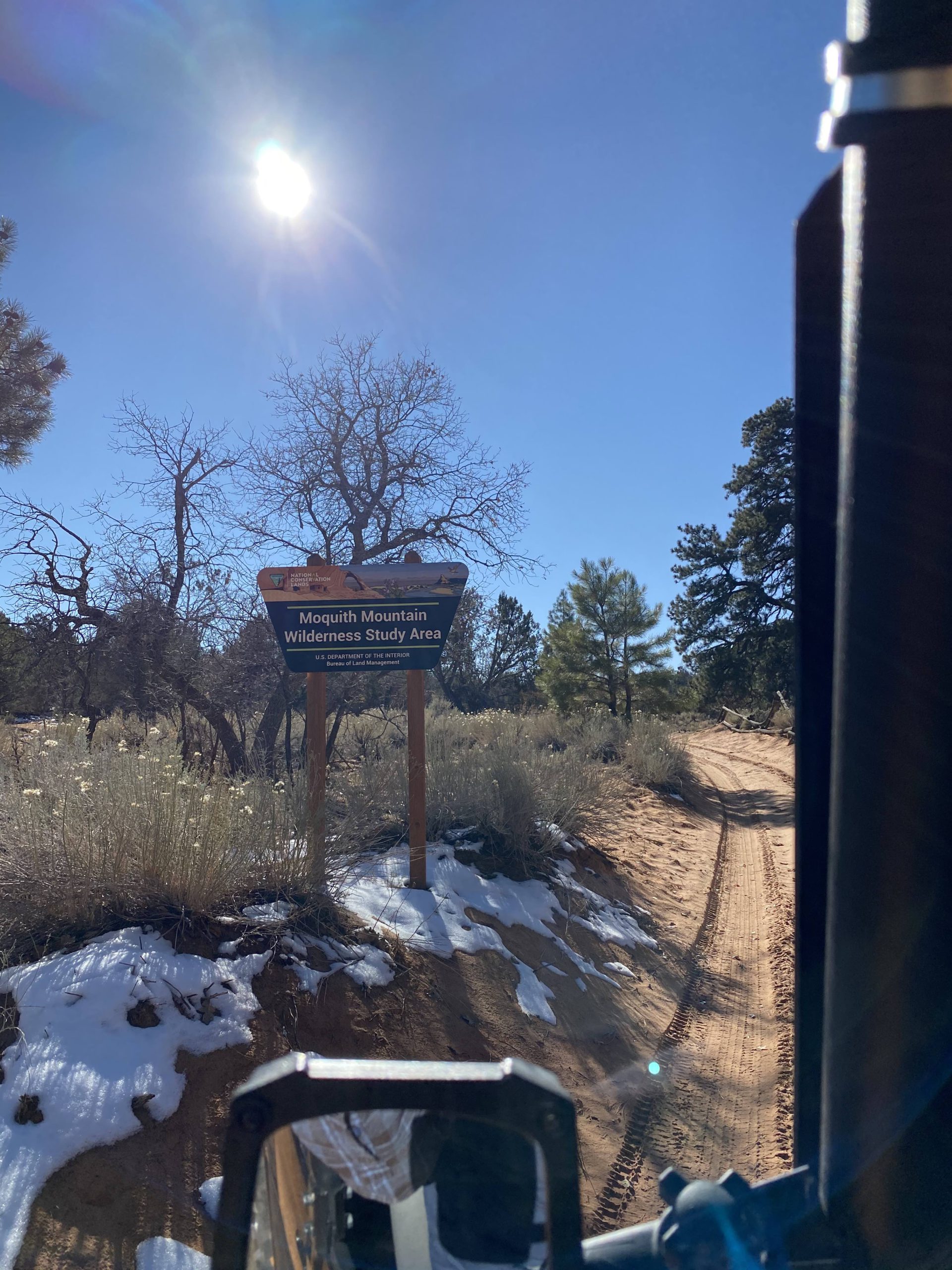
Sand Spring Road (KNFO No. 50) is a 3.5 mile OHV route that leads from Hancock Road into the Moquith Mountain Wilderness Study Area to a 1.73 mile destination hike. The Moquith Mountain Wilderness Study Area is a scenic and remote area located east of Utah’s Coral Pink Sand Dunes State Park and west of the city of Kanab. Located within the Trail Canyon TMA, it is characterized by its sandy, desert terrain and broad vistas; standing at approximately 7,000 feet above sea level, this area provides stunning views of the Coral Pink Sand Dunes and its surrounding landscape. Exploration on Sand Spring Road is well suited for any lightly equipped 4WD/AWD vehicle. The route features many twists and banked curves, leads past a primitive campsite, and ends at a footpath that leads to Native American pictographs. If you are already staging out of the Coral Pink Sand Dunes, exploring from Kanab or overland camping in the surrounding area, it is well with your while to spend a day in this naturally and culturally rich area.
Getting there:
Sand Spring Road can be reached from Hancock Road, which connects to both Highway 89 and Yellowjacket Road. Its proximity to the Coral Pink Sand Dunes makes an approach from the dunes via Yellowjacket Road and onto Hancock road a great option for those already exploring the dunes. Sand Spring Road turns off from Hancock Road at GPS coordinates 37° 5’53.11″N and 112°38’42.33″W. Once you turn off of the main road, the route becomes a nice all-terrain trail. When exploring on this route, be sure to use a a 4WD or AWD vehicle to avoid getting stuck in the area’s deep sand.
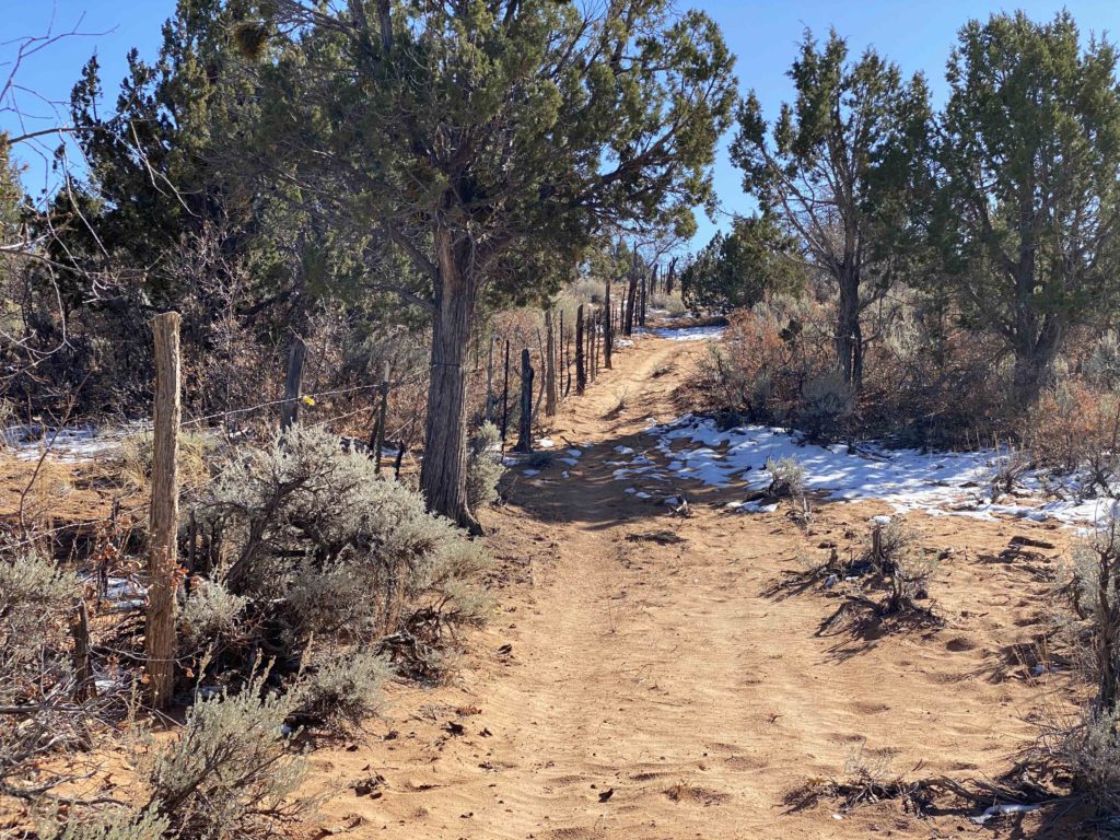
Throughout the Moquith Mountain WSA, there are several uninventoried routes that do not show up on existing maps, including the one pictured above. These trails are clearly established and well used trails, but have been missed in route inventories. This area is currently in the scoping phase for Trail Canyon’s travel management planning and all routes which are not officially inventoried are at risk of closure. BlueRibbon Coalition has fought and continues to fight to keep trails like these open and available for public use. If you encounter trails like this that do not show on your map while you are out on your adventure, please take down the trail coordinates and contact us, so that we can continue to fight for the existence of these trails. Knowledge is power.
Following the Sand Spring Road:
Sand Spring Road skirts along the edge of the Moquith Mountain WSA for almost two miles before stemming into it. Be sure to use appropriate caution; use a sand dune flag, watch for other motorists, hikers, and wildlife, and use extra caution around blind turns. As always, please also leave this area as beautiful as you found it by staying on the trail. Irresponsible recreation leads to ecological damage and route closures. BlueRibbon Coalition fights hard to keep these and other similar areas open to the public for responsible motorized and general recreational use. Recreate responsibly and keep this area open and pristine for everyone.
Just before entering the wilderness area, you will pass Sand Spring campground. This campground is best suited to primitive camping and, located just outside the WSA boundaries. It is ideally situated for a remote camping experience. We would not recommend full RV camping in this area. There are no hookups and there is a high risk of getting your rig trapped in the sand. Should you choose to camp in this area, please be sure to dispose of all waste properly and pack out all garbage. LEAVE NO TRACE.
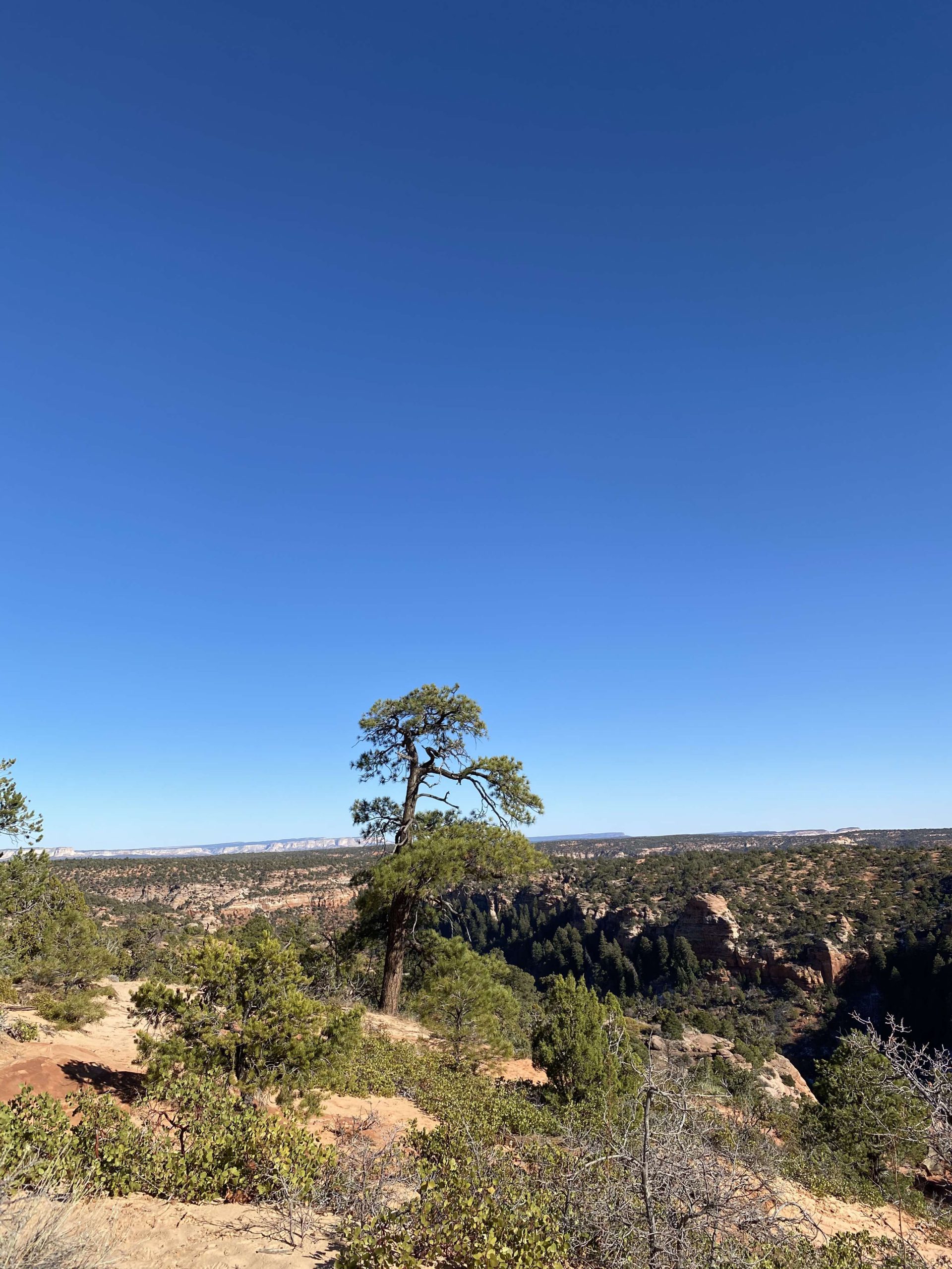
As you continue along this trail, you will find that thick vegetation often closely lines both sides of the trail. Don’t expect to come out of this adventure with your vehicle looking pretty, but do expect to leave with memories of great riding, spectacular views from the side of a desert mountain, and the awe-inspiring solitude of a remote desert experience.
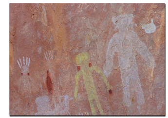
Sand Springs Road ends at the trailhead for South Fork Indian Canyon Trail at coordinates 37° 3’27.30″N and 112°40’40.62″W. This trail is designated for hiking. You will need to park and continue the adventure on foot. South Fork Indian Canyon Trail continues from this point for approximately 1.5 miles.
The petroglyphs are located as you approach the bottom of the canyon and are marked by a boardwalk and fenced off area. Please respect this cultural resource and do not alter or touch anything along the cliff face. Acts of vandalism frequently lead to area closures.

This route report is part of a larger guidebook BRC is completing to educate users about high-value motorized trails that are at risk of closure if we don’t use them. This guidebook will be called the Lost Trails Guidebook, and has been funded by a generous grant from the Yamaha Outdoor Access Initiative with Jorgensens Powersports as a sponsoring dealership.


