
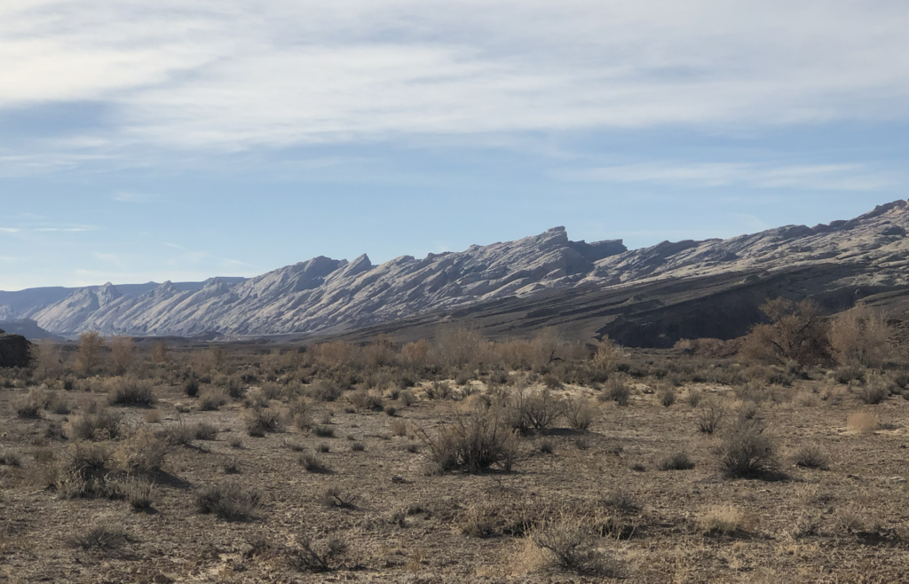
Overview: The San Rafael Swell (located just South of Price, UT) is home to some of the most spectacular deserts trails of the Intermountain West. This area is home to breathtaking sandstone cliffs and sweeping sands. Along the outskirts of the San Rafael Swell TMA, there are several lesser-known networks of BLM managed trails. These networks provide access to a nearly untouched backcountry. Within these networks, BLM Routes SS2288 and SS2379 provide access to stunning views of the San Rafael Reef and the San Rafael River. Located miles from the more popular routes in this area, your experience will be one of solitude and adventure
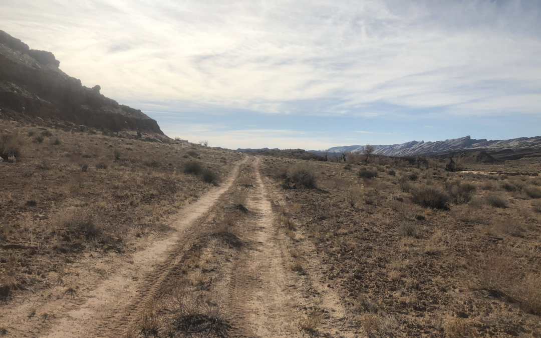
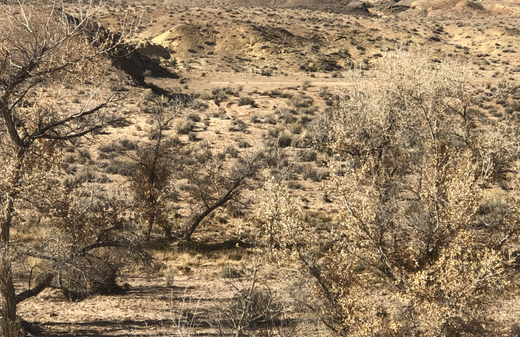
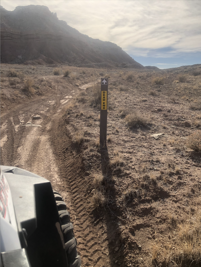
Getting There: You will exit north from exit 149 off of I-70. Just to the east there is a staging area which you can see in the first picture. As you can see there are many trails in this area that are fun to explore and offer a wide variety overlooks and dispersed camping areas. You will also be able to find several historical mine shafts. Please be careful as you are looking at these shafts. From the staging area you will head north on SS2296 which is a well maintained county dirt road. This road will then connect to SS2293 until you hit a fork in the road there you will head west onto SS2288. You can continue west until you reach the dead end that will take you to an old mining shaft, cabin and cattle corrals. However, before that you can turn South onto SS2379 to explore the Tidwell Bottoms, San Rafael River and get better views of the San Rafael Reef. There are two routes that go south SS2372 as well as SS2379 which we show in the video. SS2372 will not loop back around to the staging area and follows the base of the San Rafael Reef. SS2379 if connected to SS2370 will allow you to go back over the ridge to connect to SS2296. If you do not go East over the ridge you will hit a dead end as you can see in the bottom picture. The entire loop will take you a couple of hours. GPS Coordinates: -110.390 39.029 Degrees
View Full BLM Scoping Map for the San Rafael Swell here: https://www.arcgis.com/apps/webappviewer/index.html?id=7ab9ab7390ae4a3b8131990680a8776f&extent=-12394149.4564%2C4653898.2205%2C-12265811.6859%2C4720857.0573%2C102100
Route Conditions: These routes are more accessible than others in the area and a 2WD should be able to access these specific routes. However, if you wish to explore more routes along these trails it is recommended to have a very well equipped, high clearance 4WD or AWD vehicle for access to explore routes near here or if you intend to make a full loop.
As always, follow LEAVE NO TRACE practices. Irresponsible recreation leads to ecological damage, road closures, and loss of access to important resources. It is important that motorized users stay on the trail and camp within a 30′ buffer zone on either side of the road.

This route report is part of a larger guidebook BRC is completing to educate users about high-value motorized trails that are at risk of closure if we don’t use them. This guidebook will be called the Lost Trails Guidebook, and has been funded by a generous grant from the Yamaha Outdoor Access Initiative with Jorgensen Powersports as a sponsoring dealer.


