
Overview: The San Rafael Swell (located just South of Price, UT) is home to some of the most spectacular deserts trails of the Intermountain West. This area is home to breathtaking sandstone cliffs and sweeping sands. Along the outskirts of the San Rafael Swell TMA, there are several lesser-known networks of BLM managed trails. These networks provide access to a nearly untouched backcountry. Within these networks, BLM Routes SS4554 and SS4556 provide access to a stunning canyon overlook, two level and graveled dispersed campsites, and rugged rock crawling features. Located miles from the more popular routes in this area, your experience will be one of solitude and adventure.
Getting There: There are several ways to approach BLM Routes SS4554 and SS4556 within the many existing routes in the San Rafael Swell TMA,. If you choose to approach SS4555 directly from I-70, you can reach these routes by traveling south through Justensen Flats, along Copper Globe Mine Road toward the network of routes connected to SS4554. We recommend, however, approaching Copper Globe Mine Road more organically through networks connected to the other areas you choose to explore within the San Rafael Swell TMA during your trip.
Take time to familiarize yourself with the map and coordinates and plan a route that best fits you and your group. Be sure to not head off into the wilderness alone and tell someone where you are going before starting your trip. BLM Route SS4555 turns off of BLM Route SS4554 at GPS coordinates 38°48’3.06″N and 110°53’8.76″W.
View Full BLM Scoping Map for the San Rafael Swell here: https://www.arcgis.com/apps/webappviewer/index.html?id=7ab9ab7390ae4a3b8131990680a8776f&extent=-12394149.4564%2C4653898.2205%2C-12265811.6859%2C4720857.0573%2C102100
Route Conditions: As pictured in the lower left image, BLM Routes SS4554 and SS4556 are characterized by rock crawling features and technical terrain. A 2WD vehicle will not cut it in this area. We recommend using a very well equipped, high clearance 4WD or AWD vehicle for access to both routes.
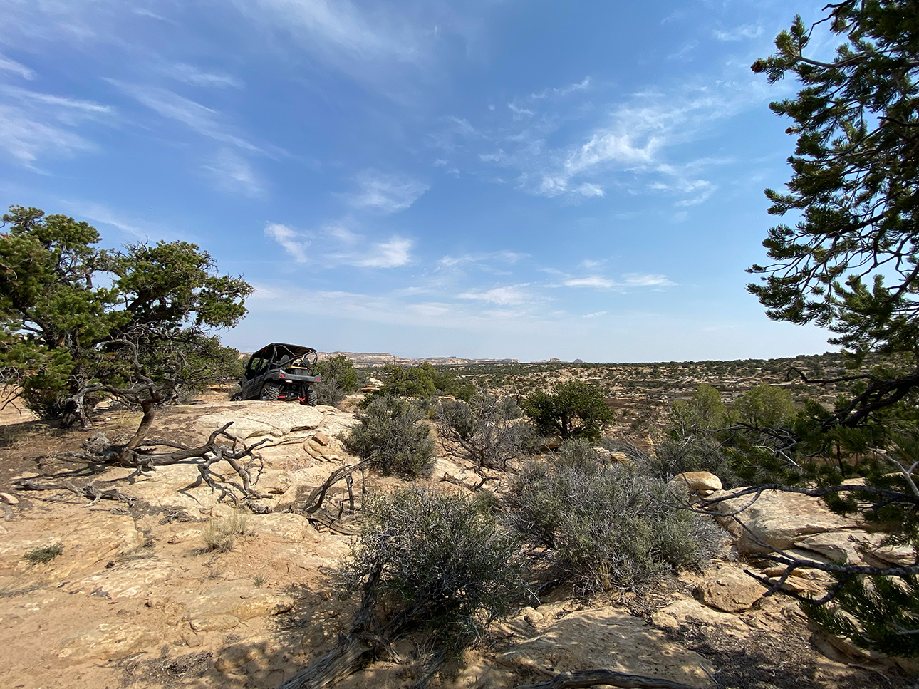
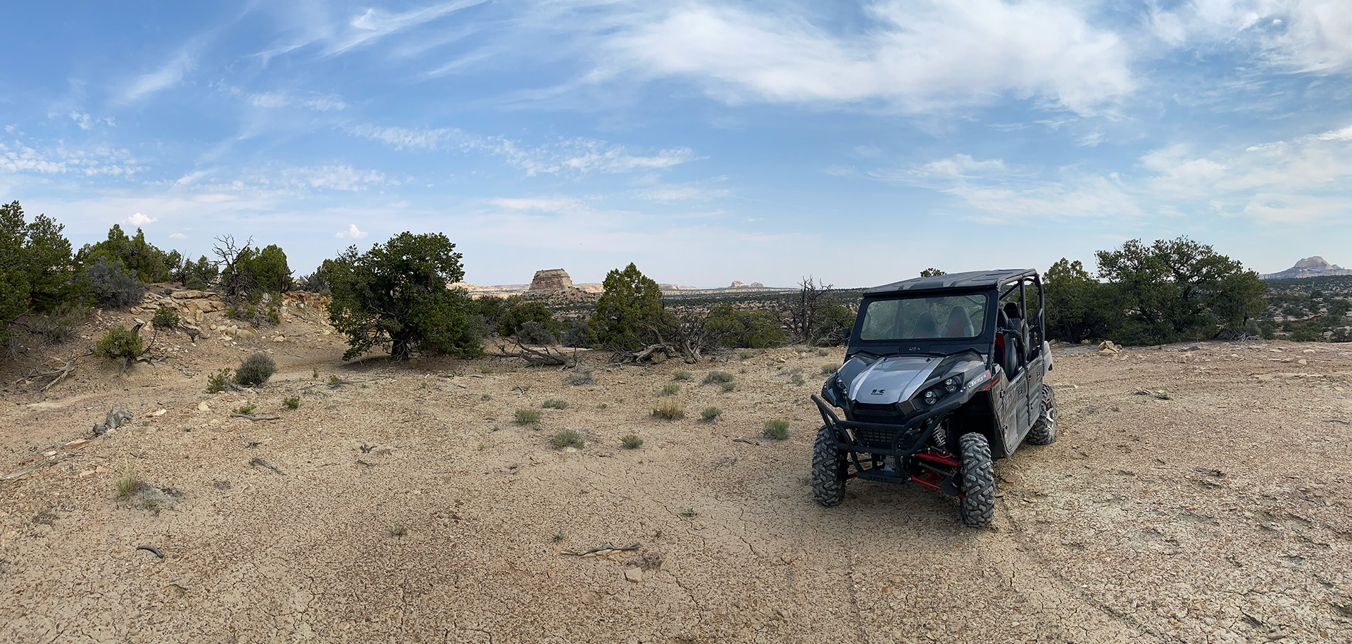
After about 3/4 of a mile, BLM Route SS4556 branches off of BLM Route SS4554 at GPS coordinates 38°48’26.97″N and 110°53’33.41″W. BLM Route SS4556 continues for about 1/4 of a miles before ending in a flat, graveled area. This endpoint is ideal for overlanding or dispersed camping (see lower right image) with great views of nearby buttes and sandstone formations. Cell service is also accessible from this site. We strongly discourage pulling trailers into this area. While the site itself is broad and level, the terrain leading up to the site is extremely rugged with washouts; you will get stuck or damage your trailer.
As always, follow LEAVE NO TRACE practices. Irresponsible recreation leads to ecological damage, road closures, and loss of access to important resources. It is important that motorized users stay on the trail and camp within a 30′ buffer zone on either side of the road.
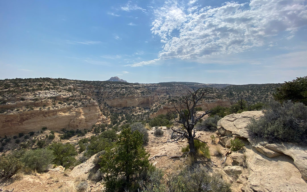
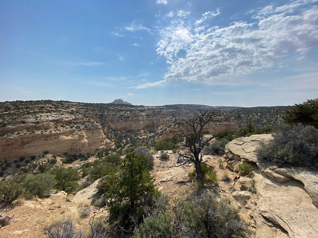
BLM Route SS4554 continues past BLM Route SS4556 for about two miles before ending at spectacular canyon overlook (see image below). You will know that you are at the right location once you reach GPS coordinates 38°48’23.16″N and 110°52’51.08″W.
These and other nearby spurs are at risk of closure under claims of natural reclamation if they are not used. Please come and enjoy this beautiful area and help to keep our roads open.

This route report is part of a larger guidebook BRC is completing to educate users about high-value motorized trails that are at risk of closure if we don’t use them. This guidebook will be called the Lost Trails Guidebook, and has been funded by a generous grant from the Yamaha Outdoor Access Initiative with Jorgensen Powersports as a sponsoring dealer.


This area needs to be open to Off Highway Vehicle use without restrictions. This is an area used by many Off Roaders and must be kept open for such use. The 800 miles are critical for OHV use. All the behind the scene deals that I’ve heard about is disturbing to say the least. This fight has been going around and around for many years at this point. I hope to come visit and ride there soon. This OHV opportunity is good for the public and a balanced approach is encouraged in your decision making going forward.
This area is home to breathtaking sandstone cliffs and sweeping sands. Along the outskirts of the San Rafael Swell TMA, there are several lesser-known networks of BLM managed trails. These networks provide access to a nearly untouched backcountry. Within these networks, BLM Routes SS4554 and SS4556 provide access to a stunning canyon overlook, two level and graveled dispersed campsites, and rugged rock crawling features. Located miles from the more popular routes in this area, your experience will be one of solitude and adventure.