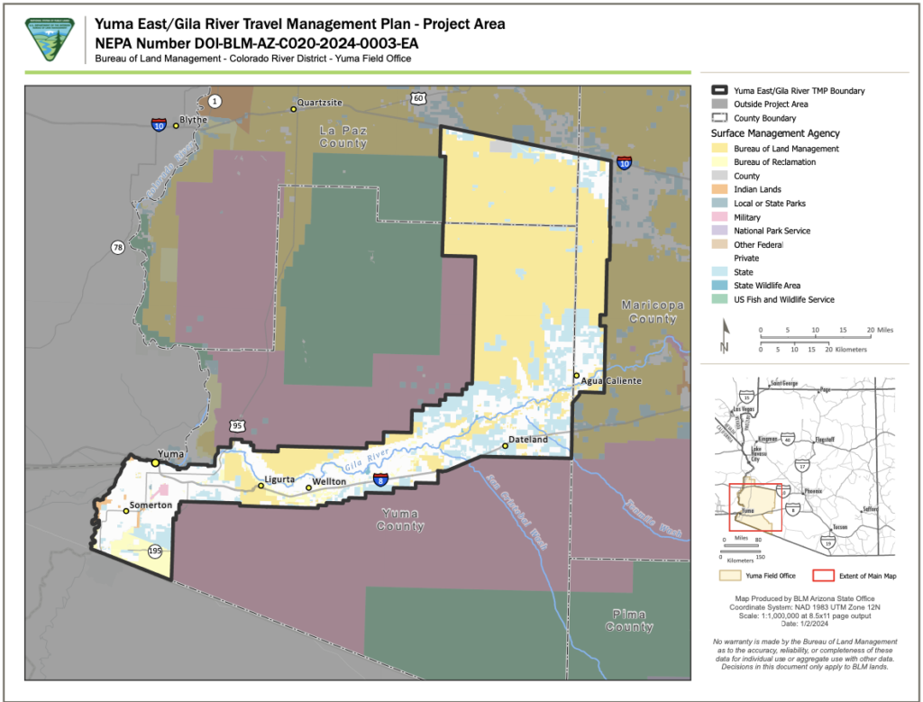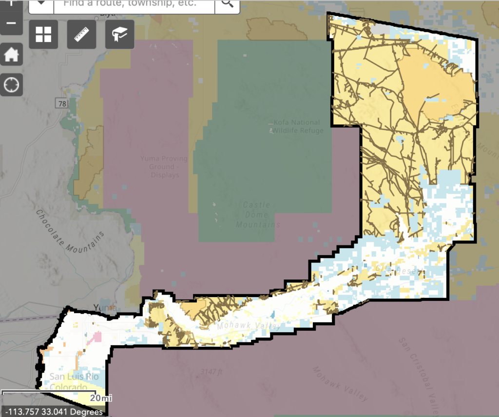
The Bureau of Land Management in Southern Arizona is starting the process of another travel management plan. You can view the details of the project here.. The BLM has conducted a route inventory showing 1,250 miles of current routes. The BLM is looking for public involvement to ensure they aren’t missing routes and to give feedback on the routes they inventoried and their purpose. This area is located southeast of Quartzite, along the Gila River, next to the Kofa National Wildlife Refuge which was put in place to protect Bighorn Sheep. The project area covers over 700,000 acres. This area is accessed for recreation, hunting, grazing, mineral exploration and energy development. Comments will be accepted until February 21, 2024.
This area includes several popular trails, such as portions of the Arizona Peace Trail. The area also includes the Eagle Tail Wilderness and Muggins Mountains Wilderness areas, which heavily restrict motorized use. The area is also surrounded by several military training ranges, which also restrict access. We need to ensure that the routes on the multiple-use land continue to provide continued access for recretion. Please take a closer look at the route inventory map and include specific routes in your comment if you have on the ground knowledge. If any routes are missing, please include those and let the BLM know which areas and routes are important to you and why.