
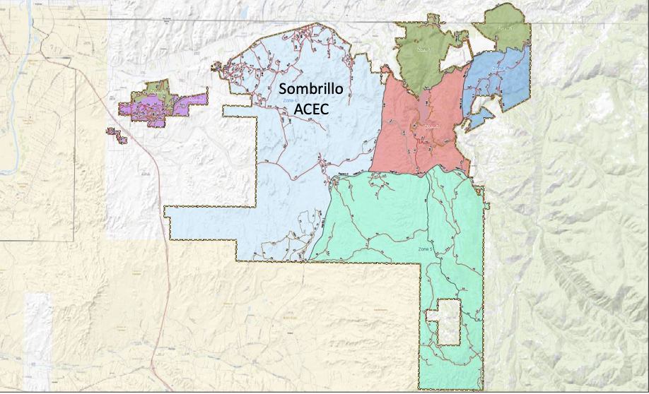
UPDATE- BLM has extended it’s public comment period to Jan. 31st to allow more time to receive substantial, site-specific comments. The agency is requesting comments be made with the attached form. The BLM, Tao Field Office in New Mexico is seeking public comment for route inventory to update the Sombrillo Area Travel Management Plan. Located in Santa Fe County, this area offers many motorized routes. In 2019 the BLM attempted to update the TMP but discovered their maps were missing routes and inaccurate, therefore they are working to update their maps to continue the process.
The following is from the BLM regarding this route inventory process:
“We need substantive comments from motorized users and horsemen (if you know any) who are familiar with the area including potential parking area locations, why you use certain trails or roads, what type of vehicles are appropriate for each route, signage needs that can support the multi-use experience etc. Some users have identified main drainages as OHV trails, but how can the BLM manage and sign for the safety of those who don’t understand flash floods? Ideas?
There were areas identified in the public meetings that OHV users tend to focus on, but no one at the meetings knew the numbers, frequency, parking needs, what are the objectives-out and back or loop trails etc as they tended to focus on the areas local to their homes. We need the voices of those who use the area to help us in this planning effort.
We also needs folks from the OHV community who are willing to join us at public meetings so you can make comments and help in the planning effort along side other user groups. I have done this successfully elsewhere and together the groups identify routes that will work for one group over another, identify dead-end routes that go to great overlooks and how to reduce conflicts or educate all the user groups to share the trails.
The Route Inventory comment deadline has been extended to January 31, 2022. Locate the files dated 11/19/2021 at https://eplanning.blm.gov/eplanning-ui/project/120294/570.
Examples of substantive comments include:
• Route 245F should be open for administrative use. I need the road to access my private land for which I have a Right-of-Way.
• Route 215Fshould be closed as it crosses private property and fence cutting and illegal dumping occur on a regular basis.
• Route 575F should be rerouted to connect with 578F to avoid Rock and Roll Creek to decrease erosion and limit the number of creek crossings.
• GPS location___.____.____ would be a good location on public lands to build a parking area that should include 5 pull-through horse trailers parking spots as well as 10 additional vehicle parking spots.
Tips for providing substantive comments:
• Include any knowledge, experience or evidence as it relates to your observations and comments-
Examples:
• “Route 575F has conflicts between bikers and hikers due to bikers speed, it should be designated as mountain bikes only with directional use”
• OR “Route 575F has conflicts between hikers and bikers but it is the only route to Route 576, 577, 578 and should include design features that slow the speed of mountain bikes and designated as
Non-motorized”.
• “At Rock and Roll Creek I observe 5 ATV trailers every weekend and 10 cars with bike racks parking along the shoulder. This would be a good spot for a multiple use trailhead with 10 trailer parking
spots and room for an addition 20 cars and an information kiosk”.
• Provide GPS readings or landmarks, if possible, when referring to specific locations.
• Present new information.
• Share issues relevant to the environmental analysis.
• Suggest alternatives to the proposed project and the reason(s) why they should be considered.
You can then e-mail the the form to Judy Culver at BLM_NM_TAFO_Admin@blm.gov.
BLM is asking for any information we can give them regarding specific roads and trails, whether users want loops and where. They want to identify needs for staging areas, trailheads, sizes needed and how much use areas are getting. If you have any area specific information please let the BLM know what you would like to see moving forward.
Emergency response teams have informed the BLM that there are many user-created routes that would be beneficial to designate as open. They have not received as much input from the OHV community as they would like. The past alternatives greatly restricted motorized use and we could see similar alternatives proposed in the future if substantial comments are not submitted. You can look at the maps and read more regarding the BLM plans here.
You can still use our action alert below to submit a comment in support of keeping all areas open.


Please allow and protect motorized vehicle use of existing trail networks.
This is an area we ride almost every year in the spring on our trip around the south. Please keep all the ATV/UTV routes open
This is a area we camp and ride dirt bikes. Please keep the area open for usage