
Overview: BLM Route 679, located in the San Rafael Desert south of Green River, UT, is a 1.5 mile spur that leads to a spectacular overlook of the Green River as it skirts along the cliffs into the heart of the Labyrinth Canyon Wilderness. As one of the congressionally designated cherry-stemmed roads in this wilderness area, it cuts through some of the most spectacular scenery in the San Rafael Desert. As a cherry-stemmed road, it is important that motorized users stay on the trail and camp within a 30′ buffer zone on either side of the road. The trail boasts several existing dispersed campsites and is accessible to any well-equipped, 4WD vehicle. This route would make a great destination for anyone wanting to get off the beaten path in one of Utah’s most remote and lightly visited areas.
Getting there:
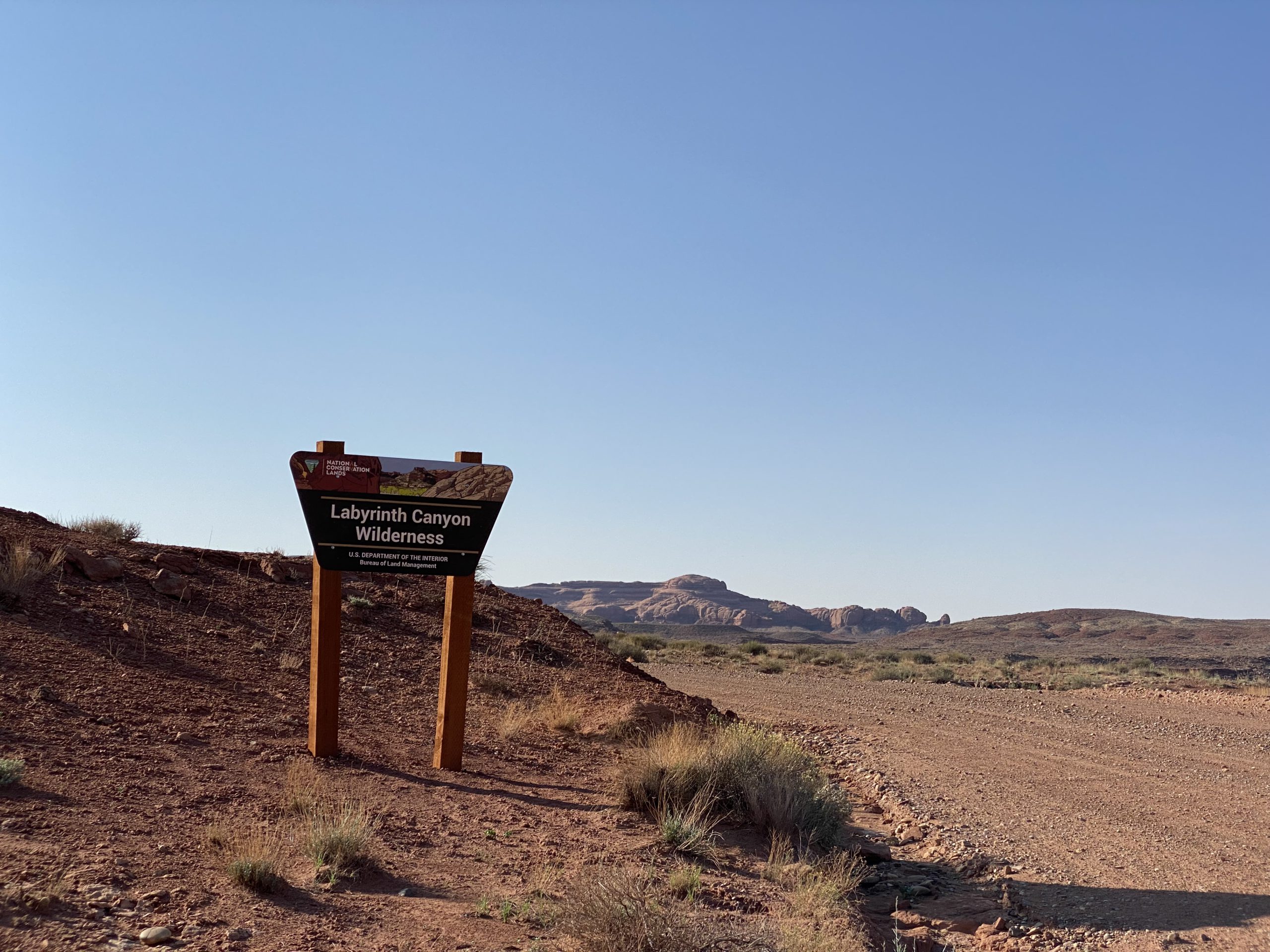
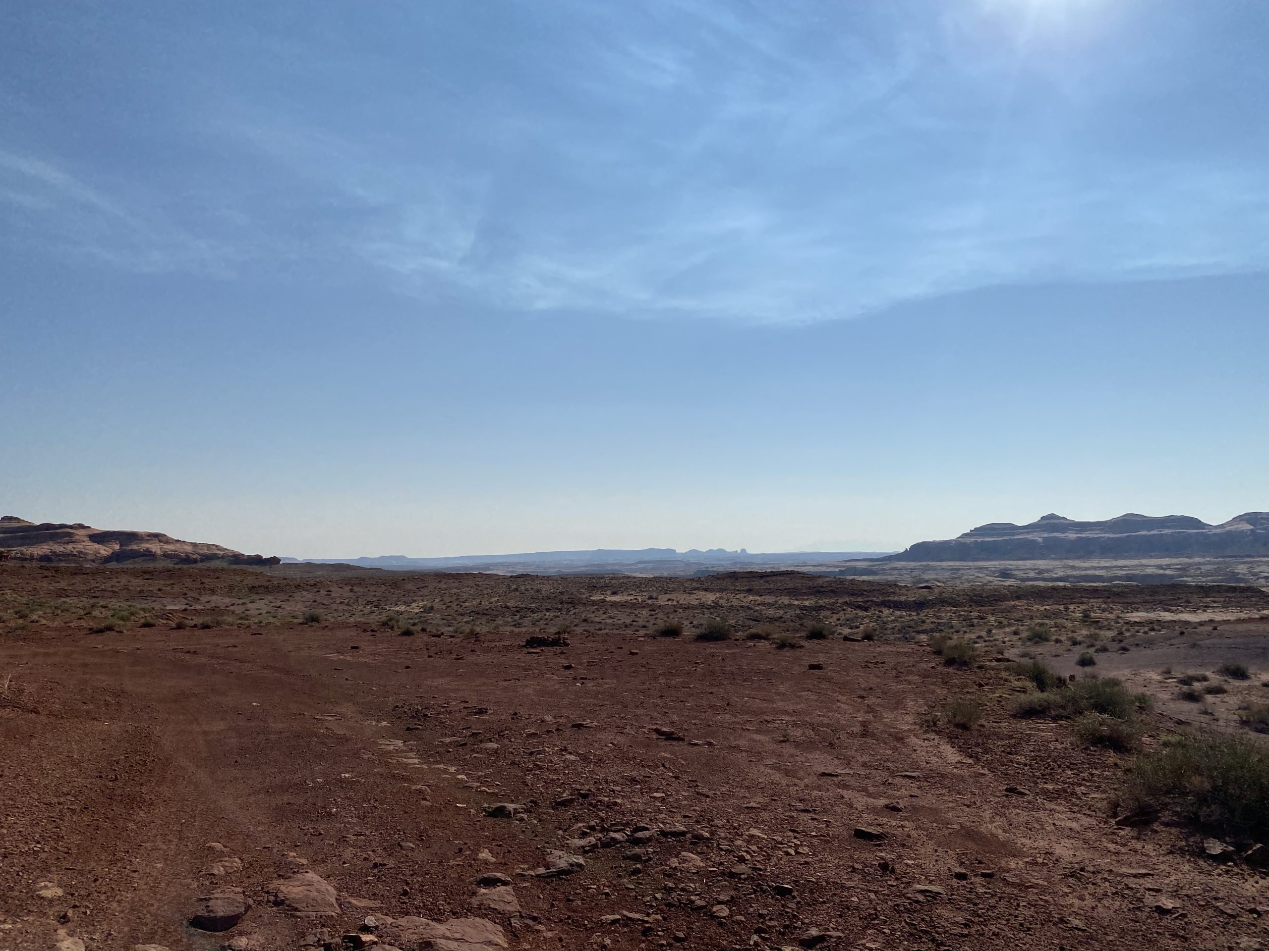
There are several ways to approach SD679 within the many existing routes of the San Rafael Desert. Take time to familiarize yourself with the map and coordinates and plan a route that best fits you and your group. Be sure to not head off into the wilderness alone and tell someone where you are going before starting your trip. SD679 turns off from the main road, SD421, at GPS coordinates 38°42’39.09″N and 110° 8’45.82″W.
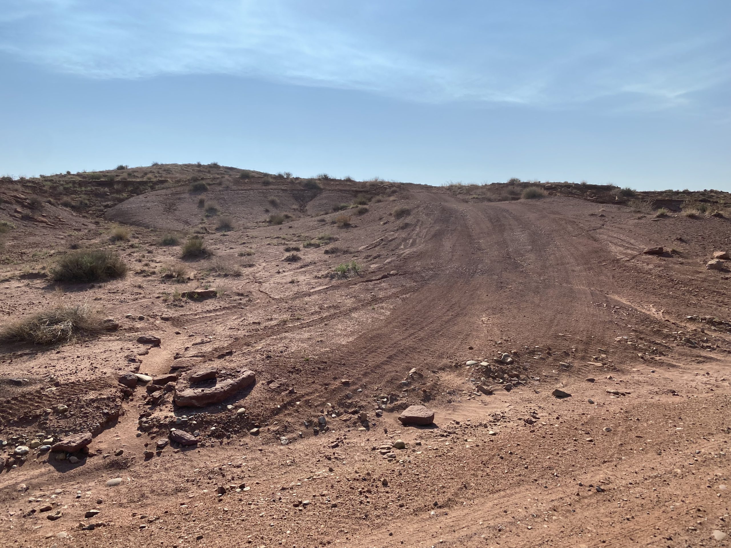
This is what it looks like as you approach the route. As you can see, the main road is a well maintained, graded route and is accessible to most vehicles; however, all motorists who drive past the main road will best served with a 4WD vehicle. Pictured on the right is the turnoff from the main road onto route SD679.
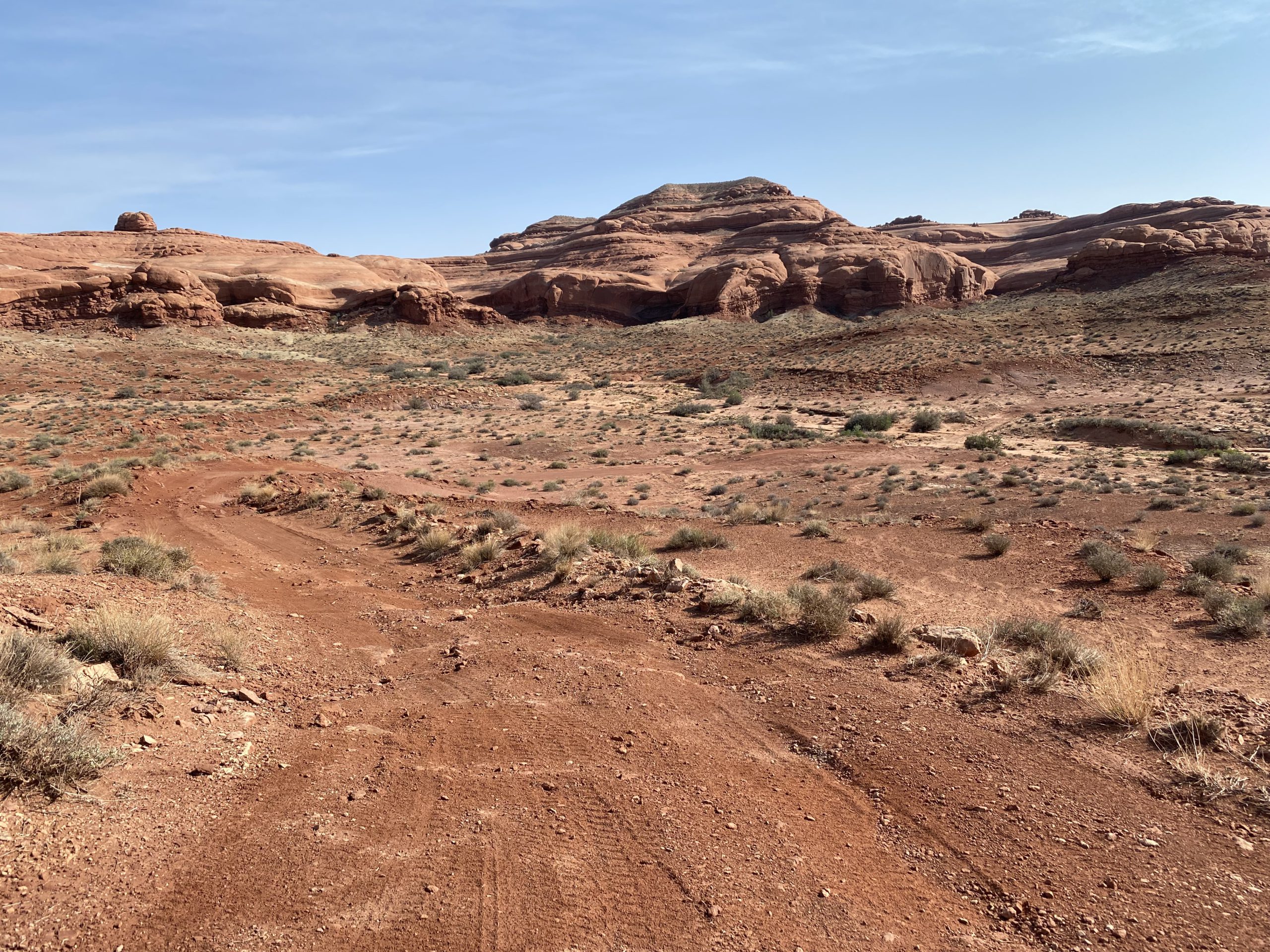
About three to five minutes up route SD679, you will find the route’s first, existing dispersed campsite. It is located far enough up the road that you feel isolated from the main road and provides a nice site for camping. While this first dispersed campsite serves as an excellent site, we strongly recommend that you head to the end of the route for an even better dispersed camping experience.
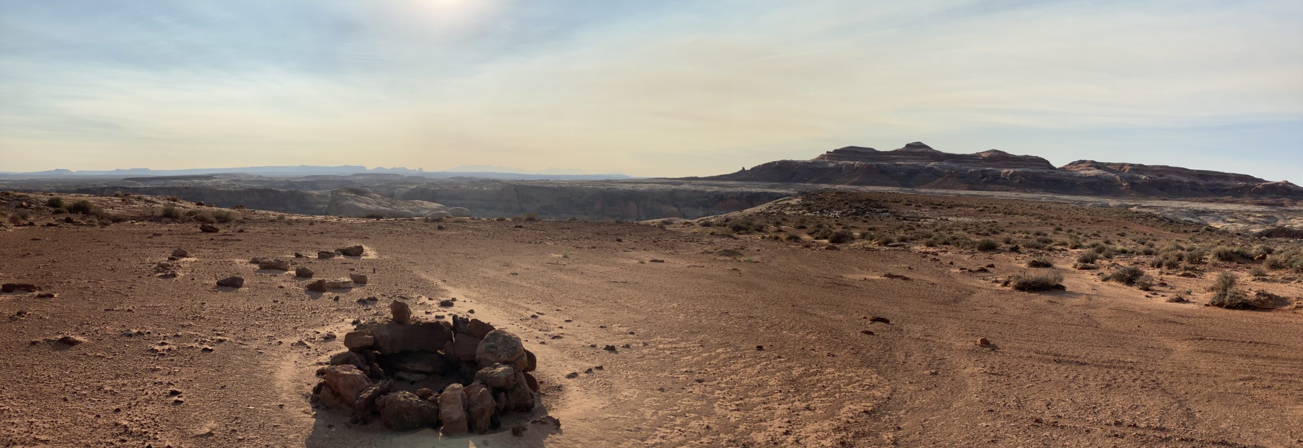
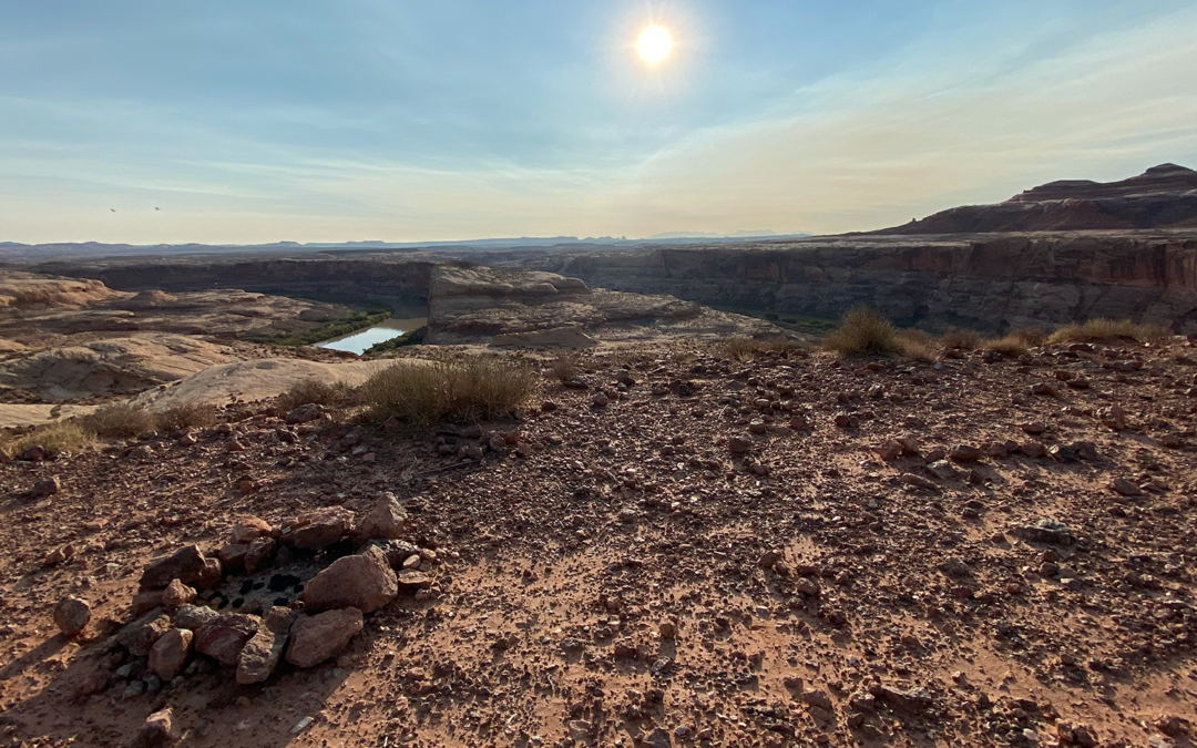
As pictured above on the right, the spur’s second dispersed campsite is located adjacent to a stunning overlook above the Green River that provides excellent views of the river and of the surrounding sandstone formations. You may also catch sight of the State’s largest big horned sheep heard, peregrine falcons, burros, wild horses, and prong horned antelope.

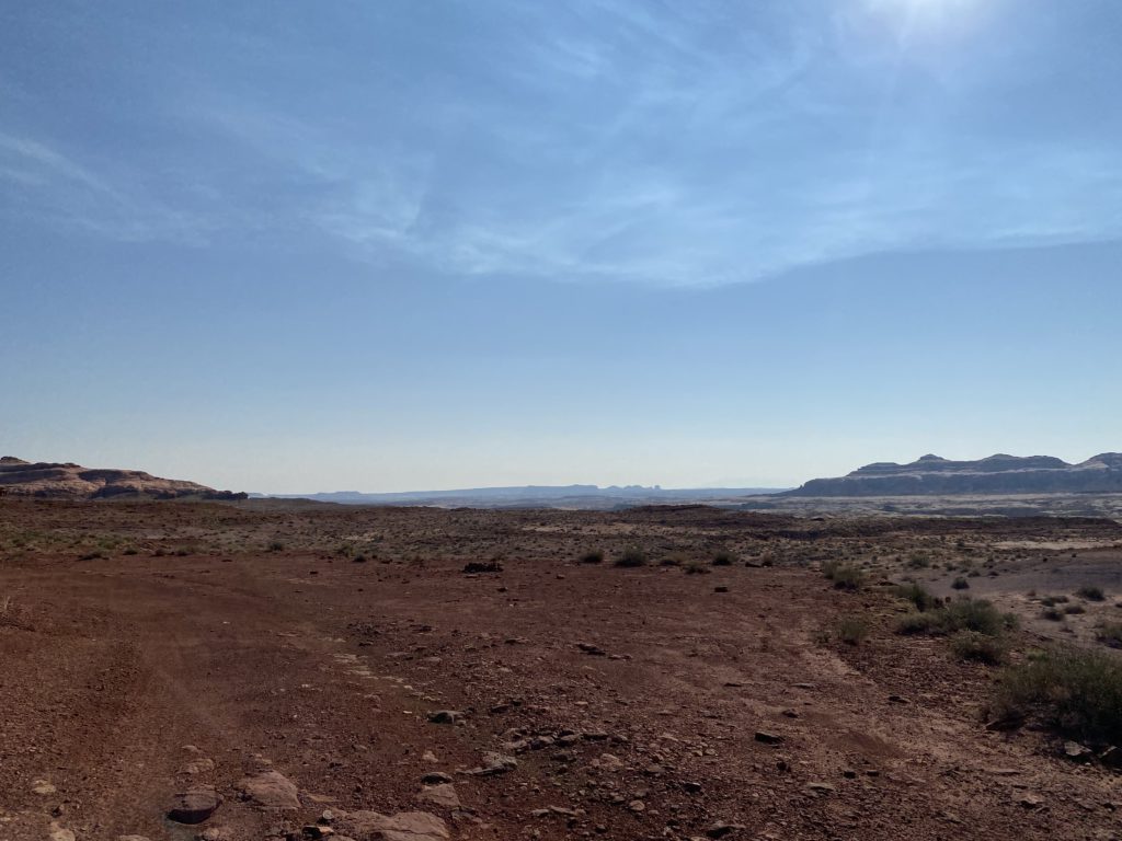
The above picture provides a good feel for the condition of the road. This trail forms a fun, curving detour along some of the San Rafael Desert’s most beautiful red rock cliffs, canyons, and overlooks. It is well used and has plenty of bumps, twists and turns, giving the well-equipped motorist an adventurous, rugged trail experience. Be sure to stay on the trail and use LEAVE NO TRACE practices.
This trail is a cherry-stemmed route into one of Utah’s most pristine wilderness areas. As you drive along this route, you will notice that there is no evidence of anyone driving their vehicle off-trail. Don’t be the motorist to change that. This is a protected wilderness area that is valued for its untouched beauty and ecological health. BRC and other motorized recreation organizations fought to keep these cherry-stemmed roads open during the Dingell Act negotiations, and the wilderness advocates wanted these routes closed. Irresponsible recreation leads to ecological damage and route closures. Recreate responsibly and keep this area open and pristine for everyone.

As you reach the end of route SD679, you will find several additional fire rings for dispersed camping, views of beautiful rock formations in every direction, and a jaw dropping overlook that sits several hundred feet above the Green River. You know you are at the right spot if you reach GPS coordinates 38°42’35.20″N and 110° 7’31.59″W.

This route report is part of a larger guidebook BRC is completing to educate users about high-value motorized trails that are at risk of closure if we don’t use them. This guidebook will be called the Lost Trails Guidebook, and has been funded by a generous grant from the Yamaha Outdoor Access Initiative with Jorgensens Powersports as a sponsoring dealership.


Any and all trails for ATV or UTV travel should be left open for the recreation and enjoyment of the many, many people who utilize them on an annual basis. Not for just a select few to be able to say to one another, I shut that down.
As a elderly couple waiting to travel after retirement we would like to be able to go to this part of the country. Please keep this opem.